

Parking and Directions
Please read the following information carefully to avoid race day hiccups - as the parking lots are located some distance from the race venue.
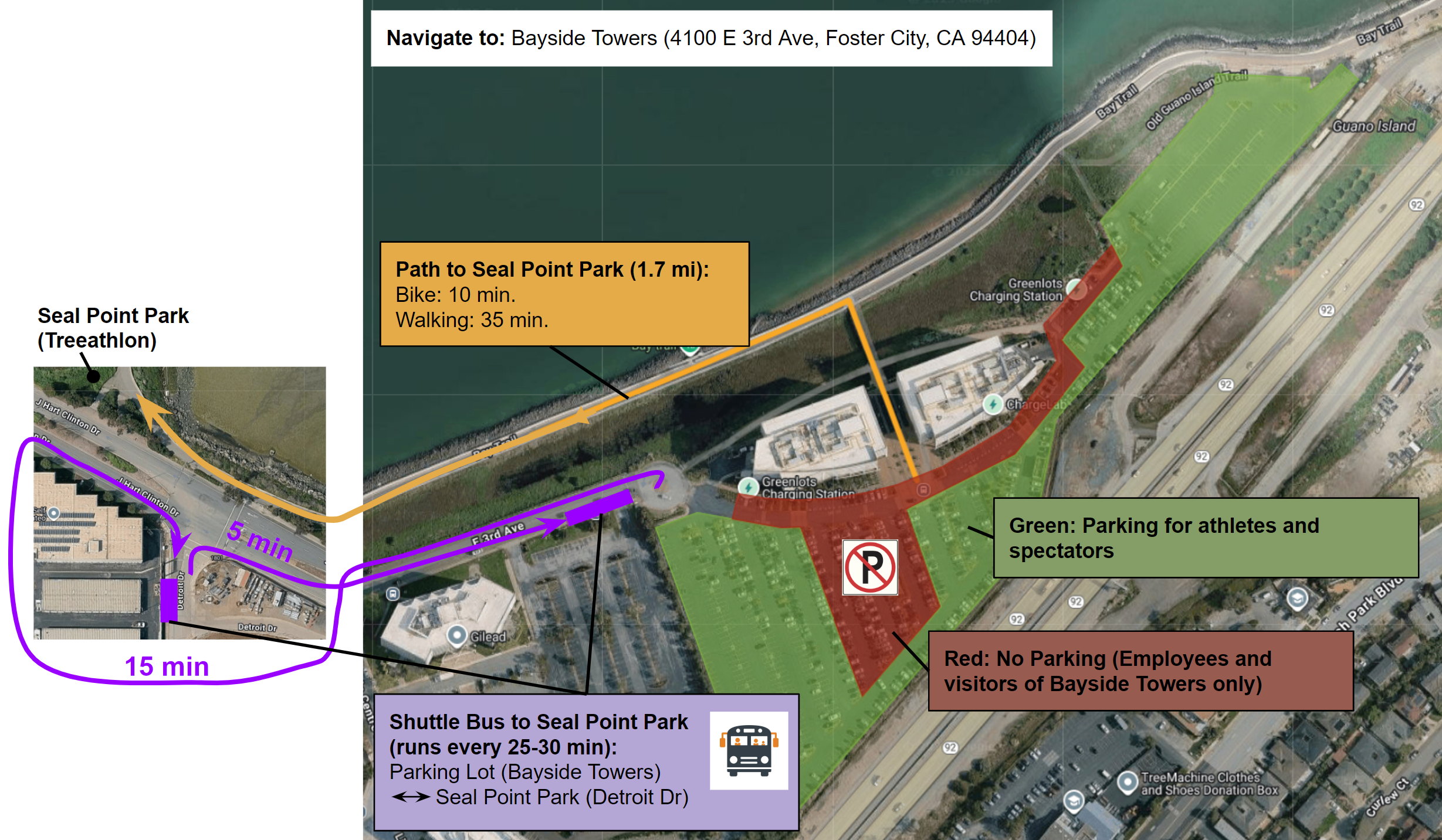
Parking for athletes and spectators is provided at Bayside Towers, San Mateo.
Navigate to: Bayside Towers (4100 E 3rd Ave, Foster City, CA 94404).
To access the race venue (Seal Point Park, San Mateo, CA) from the parking lots, there are two options:
By Bike or Foot: Follow the Bay Trail or 3rd Ave west to Seal Point Park (1.7 mi, 10 min biking, 35 min walking).
By Shuttle Bus: Take our free Shuttle Bus that runs every 25-30 min between the parking lot (Bay Side Towers) and the race venue (Detroit Drive). Check the maps below for the exact shuttle stop locations. Approximate travel times are 15 min (Parking Lot to Seal Point Park) and 5 min (Seal Point Park to Parking Lot). Be prepared that bikes and pets may not be allowed on the bus.
Below is a map of the designated parking areas. In addition, street parking may be available along Mariner’s Island Boulevard.
No Parking or Stopping at the following locations:
The parking lots of Seal Point Park, Ryder’s Park, and Mariner’s Point Viewing Platform will be closed on race day.
No Parking or Stopping at Mariner’s Point Golf Course or other private businesses.
No Parking or Stopping on the shoulder along J Hart Clinton Drive between Church Rd and Mariner’s Island Blvd.
For more details, see our Interactive Map and Public Notice.
If you have any questions, please reach out to treeathlon@gmail.com.
On race day there will be volunteers and signs to direct you in the correct direction.
Public Transport
The race venue (Seal Point Park, San Mateo, CA) can be reached via public transport:
The closest CalTrain station is “San Mateo” (7 min biking, 25 min walking).
The closest SamTrans bus stop served on a Saturday is “S Norfolk St & Shoreview Ave” (3 min biking, 8 min walking).